GeoSection Map English 10.0

- Categoría: Graphic Editors
- Licencia: Shareware
- Tamaño: 10.07 KB
- Sistema: w2000 wXP vista
- Idiomas:

The program for reading topographical maps.
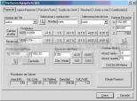
GeoSection Map is an essential graphic tool for all topographers who use the Map program, as it lets you edit the terrain lines.
It is difficult to number the features of GeoSection Map, but some of the best include: it comes equipped with a multitude of maps and topographs, you can take field readings, adjust, draw level curves, create longitudinal profiles, insert transversal vertices and sections, make calculations to find volumes, create hierarchical modules of each implicated process, etc.
Other interesting features of GeoSection Map include: it has co-ordinate conversion tools, you can minutely document each of the descriptive memories, add notes and observations, forecast terrain movements, etc.
DownloadGeoSection Map English 10.0 related downloads
ACDSee Photo Manager 18
 Download
International versions of this excellent image administrator and viewer, with many supplementary functions.


